Share
Department of Regional Planning and Development
Office of Geographic Information Systems (GIS)
Office of Geographic Information Systems (GIS)
Ranae Fehr, Department Head
P.O. Box 719
Rt. 9 and Dolphin Ave.
Northfield, NJ 08225
Phone: (609) 645-5898
Fax: (609) 645-5836
Questions/Comments?
Email the Public Information Officer - pio@atlantic-county.org
or use our contact form.
General Interest
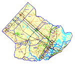 This collection of maps include various representations
of different projects that the Office of Geographic Information Systems has developed in the past few years. These map compositions cover a broad
range of topics both of interest to the entire county and of interest to specific areas within the county. Some of the data developed while creating these maps and analyses have been invaluble to Atlantic County
and its municipalities.
This collection of maps include various representations
of different projects that the Office of Geographic Information Systems has developed in the past few years. These map compositions cover a broad
range of topics both of interest to the entire county and of interest to specific areas within the county. Some of the data developed while creating these maps and analyses have been invaluble to Atlantic County
and its municipalities.