Share
Department of Regional Planning and Development
Office of Geographic Information Systems (GIS)
Office of Geographic Information Systems (GIS)
Ranae Fehr, Department Head
P.O. Box 719
Rt. 9 and Dolphin Ave.
Northfield, NJ 08225
Phone: (609) 645-5898
Fax: (609) 645-5836
Questions/Comments?
Email the Public Information Officer - pio@atlantic-county.org
or use our contact form.
Flood Hazard Mitigation
 Flood hazard mitigation presentation of findings were presented by the Office of GIS, Office of Emergency Management and the County Administrator to the municipalities on October 5, 2007. The papers below are part of the Flood Control Study completed by the Atlantic County Department of Regional Planning, Office of GIS. If you would like a copy of the completed study, please email the GIS coordinator.
![]() Flood Hazard Mitigation Report of Findings
Flood Hazard Mitigation Report of Findings
![]() Flood Hazard Mitigation Presentation Handout
Flood Hazard Mitigation Presentation Handout
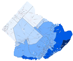
County Map Examples*
- Hamilton Township
- Coastal Flood Evacuation Zones
- County Series 6 Projects
- County Series 7 Priorities
- Evacuation Routes
*Additional maps available in the full study ZIP file above, if you have any questions email the GIS coordinator.